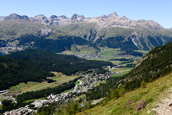
Hairpin turns after hairpin turns aboard a dizzying PostBus ride, we crossed the Alps and descended into a land of medieval citadels, Renaissance squares and a familiar romantic tongue. Road signs abruptly switched languages and so did our previously German-speaking bus driver.
This can’t still be Switzerland, right?

Except the train station still proudly brandished its SBB signage, and the Swiss red-and-white still flew above the town’s historic bastions. We’ve arrived at Switzerland’s southernmost canton, a small outcrop of Swiss territory wedged into Italian Lombardy like an old hatchet. A few kilometres further and we’d be on the lakeshore of Lago di Como, with Milan being less than an hour away.

This was only our 5th day in Switzerland as we moved from German-speaking Appenzellerland to the Romansch enclave of Graubünden, and now onward to the Italianate canton of Ticino. The crisp mountain air of St. Moritz -- a brisk 5 degrees in the morning compared with our sweaty 26 degree afternoon in Bellinzona -- now seemed a distant memory.

While the Bernina Express via Tirano may be popular, the most direct route from St. Moritz to Bellinzona is an SBB express train to Thusis followed by a nauseously winding bus ride through the San Bernardino Pass, dropping 1000m in elevation before arriving at the cantonal capital in a total of 3.5 hours. The air turned noticeably humid once we passed through the Alps, now imparting an unmistakeable musty scent that proclaimed its Mediterranean climate.

Often romanticized by tourism brochures as the perfect marriage between Swiss orderliness and Italian flair, the real Ticino is somewhat in the middle. Notwithstanding its handsome looks, cities do appear a little more scruffy and trains a little less punctual compared with cantons to north of the Alps. But that’s the uniqueness of Ticino.

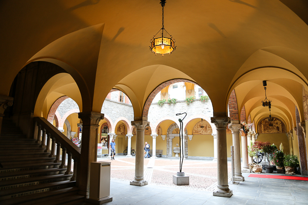
Stuffing our heavy backpacks into a train station locker, we mapped out our half-day itinerary starting from the charming inner courtyard of Palazzo Civico, past the Renaissance marble façade of Chiesa San Pietro e Stefano and reaching the first of Bellinzona’s three castles, centrepiece in a network of medieval fortifications that once defended the Ticino Valley against the expanding Swiss Confederates.

Within seconds a well-camouflaged elevator whisked us from Piazza del Sole up to the grassy courtyard of the aptly named Castelgrande, set upon a colossal natural rock and dominating the valley from the time of the Roman Emperors. Aside from providing some green space for local citizens to enjoy on their lunch breaks, the castle also features impressive crenellations that now provide the perfect support for camera tripods.

Armed with a map and useful advices from the Tourist Info office, we took on a little hike towards the hilltop castle, 90 to 120 minutes according to the office staff but significantly shorter according to my own estimation. With an elevation gain of just 230m and in milder climate, this was nowhere near the Walls of Kotor in terms of physical exertion.

Midway up the hillside stands the second castle known as Montebello, 90m above Castelgrande and historically linked to the lower castle via its series of monumental ramparts that controlled access to the strategic alpine passes northward towards the Rhine and the Danube. From this height the patterns of medieval town planning become obvious: little claustrophobic alleys radiating from two cobblestone squares that still hosts Saturday open-air markets in a centuries-old tradition.

From the Middle Ages until the arrival of the steam engine, these castles guarded the vital crossroads of alpine routes connecting the Swiss Confederates of the north with the Italian city states -- Milan in particular -- of the south. In time these formidable defenses, unique in the entire Alps, became Switzerland’s most impressive castle and a bonafide UNESCO World Heritage Site.

After a quick stop at Montebello’s little museum, we continued our hike past the local vineyards towards the third castle of Sasso Corbaro, now hosting a scenic restaurant and venue for artistic exhibitions. Built by the Milanese over a six month period after being routed at the Battle of Giornico by a Swiss army less than a tenth of its size, the new fortress never managed to turn history’s tides when the orphaned Bellinzona chose to join the Swiss Confederation a few decades later.

Among the vineyards stands the eye-catching Chiesa San Sebastiano, famous for its ancient fresco from the twilight years of the Roman Empire. 90 minutes turned out to be generous for this hike even with plenty of photo stops, bringing us to Sasso Corbaro at around 15:00 with time to spare before the next bus back to town.

Panoramic views as far as Lago Maggiore was our reward atop Sasso Corbaro, now a 45 minute walk -- or in our case a 10 minute ride on one of the two afternoon buses serving hikers and restaurant patrons -- back to the train station where we would be united with our backpacks. It would take another 30 minute train ride before we would reach our hotel at Locarno.

For budget travelers like ourselves, Locarno’s main attraction was the cheap prices of its hotels -- one-third off Bellinzona’s in general -- in a laidback lakeside setting. Our no-nonsense hotel room at Al Pozz, fully equipped with a functional kitchen and a washing machine, was our second cheapest accommodation over two weeks in Switzerland.

The main reason for cheap prices of course was its proximity to the Italian border, merely a 30-minute drive along the palm-lined Lago Maggiore where boats flying both Italian and Swiss flags were not uncommon. Roads on the lake’s right shore would lead to Piedmont in the direction of Torino, while the left shore would lead to Lombardy and Milan.

Dominating Locarno’s old town is Switzerland’s largest town square, fittingly named Piazza Grande and best known for hosting Switzerland’s premier film festival every August on a ginormous open-air screen.

A torrential rainstorm nearly squashed our chance to see Locarno’s historic quarter, but the rapidly changeable Swiss weather offered enough of a break the next morning for exploring the old town’s collection of steep medieval alleys that all converge towards the covered arcades of Piazza Grande.

Our excursion would last barely 90 minutes before our next train would deliver us in the general direction of southwestern Switzerland. But this would not be a Swiss train and its destination wasn't even Switzerland. As obscure as this may sound, the most direct route between southeast and southwestern Switzerland is actually via a charming Italian town known as Domodossola.


